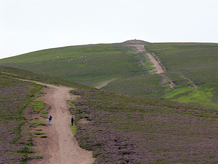
 View of the Summit from the Half-Way Point |
The imposing rounded bulk of Tinto stands south of Lanark, west of Biggar and the River Clyde, and east of the M74. Its height, 711m or 2,334ft, and its relative isolation, mean it commands views across a large part of southern Scotland and beyond. Amongst the peaks visible from the summit, on a clear day at least, are Skiddaw in the English Lake District and Lochnagar in the Cairngorms.
Tinto's central location and easy accessibility from much of the Central Lowlands make it one of the most frequently climbed hills in southern Scotland. The usual starting point for the climb is a car park off a minor road a third of a mile south-west of the A73 at Fallburn near Thankerton. The path to the summit is almost exactly two miles long, and anyone following it gains some 1,600ft en route.
The climb to the summit can be regarded as a no more than a strenuous walk. The path is largely dry, though stretches of gravel and the occasional steeper section means that care is still required, especially in descent: and boots, waterproofs, warm clothing and some navigational ability are all highly recommended. This is, after all, Scotland, and Tinto is as prone as any other mountain of its height to sudden changes of weather and loss of visibility.
A climb of Tinto offers the usual benefits of ever expanding views as you gain height. The summit is visible from the car park at the start of the climb, and it drifts in and out of view as you make progress towards it. The route breaks into two quite distinct halves, with the division between them coming as you crest the summit plateau of Totherin Hill, a northern shoulder of Tinto. The lower half of the path starts out reasonably gently before climbing rather more steeply up the side of Totherin Hill. The ground underfoot is good on the easily graded parts, and reasonable, if a little rocky and rubbly in places, on the steeper sections.
Added interest is provided on the lower slopes of Tinto by Fallburn Hillfort, a superbly preserved circular hillfort with a series of concentric ramparts. Measuring some 60m in diameter, this lies immediately to the east of the main path, a third of a mile from the car park. Today the hillfort is home only to sheep, but 2000 years ago it would have offered a degree of protection and security to the farming community in the area, in an era of considerable insecurity.
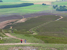
As you come over the upper edge of Totherin Hill your attention is drawn to the path ahead, leading to the summit of Tinto. This is much broader than on the lower half, and the surface has a natural gravel coating that makes walking up (or down) it unpleasant. Which is why the path is getting steadily wider as people choose to walk instead along the easier surface offered by its peaty or grassy margins. A little way further up Tinto (at the intermediate ridge shown in the header picture), you find the path unexpectedly dividing. One route carries straight on, along the line shown on the Ordnance Survey map. The other curves around to the left before following the top of a ridge towards the summit. In practice there is little to choose between them, and it is worth knowing in advance that, whichever route you take, the upper half of Tinto is considerably steeper than it appears from the half-way point: something you only really appreciate as you descend.
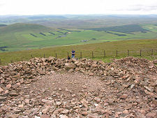
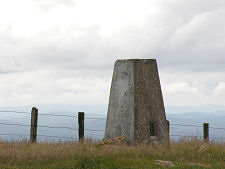
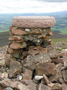
The summit is home to Tinto's second ancient monument, a huge Bronze Age circular cairn, measuring some 43m in diameter and 6m in height. Its south side has been scooped out in modern times into a series of wind shelters. This cairn helps explain why different sources give different heights for Tinto, with 707m and 711m being the most popular. 707m is the height of the triangulation pillar, more popularly known as a "trig point" which stands on the highest natural point to be found on Tinto, a short distance west of the cairn. But if the stream of walkers arriving at the top of Tinto is anything to go by, most people regard the top of the cairn as the place to be: it is, after all, the highest point for many miles in any direction. The top of the cairn is home to a crumbling summit column which once supported a viewpoint indicator.
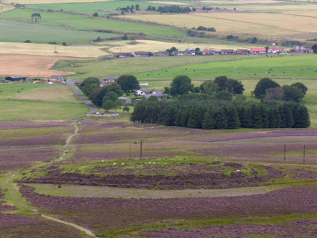 Fallburn Hill Fort Seen from Higher on the Tinto Path |

|
|
|
Visitor InformationView Location on MapTinto is 711m or 2,334ft high. The route described here involves about 1,600ft of climbing, and it is almost exactly 2 miles from the car park to the summit. Grid ref: NS 953 344 What3Words Location: ///guitars.sway.marbles |
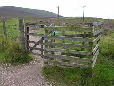 Stile Giving Access to "Tinto Hill" |
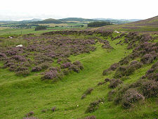 Central Area of Fallburn Hillfort |
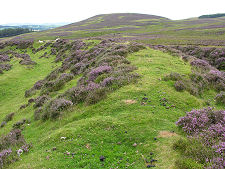 Hillfort Ramparts |
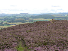 Cairn on Summit of Totherin Hill |
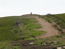 The Final Pull to the Summit |

